
Loop

1,230 m

1,067 m

7 hrs

2

250

18 +
course
Departure and arrival are at the UTCC Village.
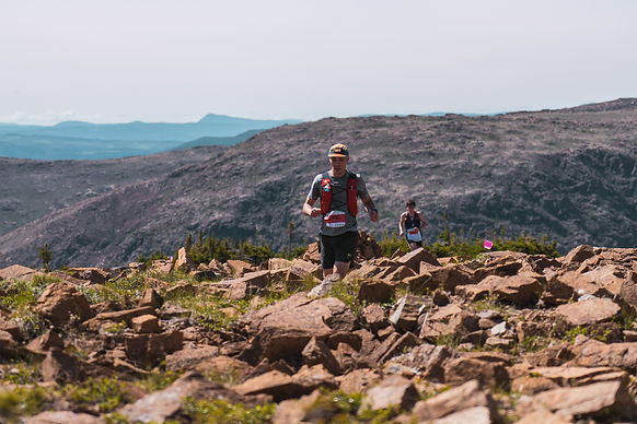
The runners start with an easy 3 km section before climbing Mont-Olivine (670 m) with its exceptional view of the Chic-Chocs. From there, you head towards La Serpentine, climb the Grande Cuve ouest du Mont-Albert, cross its plateau and descend Mont-Albert by the north face.
This last 6.5 km descent will lead you to the finish line at the UTCC Village.
There is nothing like the mythical Mont-Albert to give you a real taste of trail running!

ALTERNATIVE PATHWAY
The UTCC takes place in the protected area of caribou habitat, a vulnerable species, so the race course could be modified if a sector is closed due to the presence of individuals on the trail.
CHECKPOINTS
UTCC VILLAGE / 0 KM / LIQUID AND SOLID
LA SERPENTINE / 11,5 KM / LIQUID AND SOLID
LA GRANDE CUVE / 15 KM / FIRST AID
RABOUGRIS / 17 KM / FIRST AID
UTCC VILLAGE / 23 KM / LIQUID AND SOLID

MANDATORY EQUIPMENT
MINIMUM 1 L WATER RESERVE
ENERGY SUPPLEMENTS
CLOSED-TOE RUNNING SHOES
CAP OR BUFF
WATERPROOF JACKET
TUQUE
GLOVES
WHISTLE
RETRACTABLE GLASS OR CUP
WATER PURIFICATION TABLET OR WATER BOTTLE WITH FILTER
SURVIVAL BLANKET (140 cm x 200 cm)
BASIC FIRST AID KIT
CELL PHONE IN A WATERPROOF BAG
RECOMMENDED EQUIPMENT
INTERMEDIATE LAYER
HIKING POLES AND/OR CRAMPONS
LONG TROUSERS
SPOON AND/OR FORK
Bells are prohibited to avoid disturbing wildlife, specifically the caribou.
There will be single use dishes on-site.


